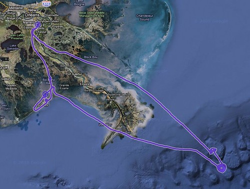
Flight Track to the Source
Earlier today, we made our first seaplane flight. Our destination: The Source. That’s what the Deepwater Horizon accident site is now known as to many of the locals who work above the Gulf of Mexico. Duncan took his GPS tracker on the flight and recorded our flight path.
The outbound portion of our flight is the leg north of the Mississippi river. You can see several places where we orbited around points of interest. The first orbit was flying around surface burning. The thick donut of orbits at the lower right is the Deepwater Horizon site. Then we headed to Grand Isle and flew around Barataria Bay before returning back to Southern Aviation’s field.
We’re all still digesting what we saw as we pull files off of our memory cards. The general consensus is that as big as you know this disaster is, seeing it first hand is something that can’t be prepared for.
